WHAT IS LASER SCANNING?
LASER SCANNING (LASER SCAN / 3D) is a non-contact method of mapping reality using electromagnetic radiation emitted and received by a scanner. The technology is based on measuring the distance and angle between the device and the target, allowing the determination of coordinates X, Y, Z points of the point cloud.
The measurement is automatic and provides a large amount of data in a very short time. We receive a collection of several million and even billions of points. In addition, on the cloud of points, you can apply a texture derived from photos taken with the camera built into the scanner – individual points of the cloud are assigned colors (RGB) corresponding to the colors registered in the photos.

WHAT ARE THE BENEFITS OF LASER SCANNING?
- REDUCED MEASUREMENT TIME – the use of a laser scanner allows you to shorten the inventory time several times compared to traditional methods
- MEASUREMENT PRECISION – the accuracy of measurements made with a scanner reaches up to ± 1 mm
- QUANTITY OF DATA – the points cloud represents the entire area within the scanner’s range of operation – no need to organize additional trips to supplement measurements
- INVENTORY OF DIFFICULT-ACCESSIBLE PLACES – working range up to 150m, enables measurements of hard-to-reach places, i.e. elevations, elements at high altitudes, places with limited access
- SAFETY – scanning is a non-contact measurement method and the emitted laser beam is safe for the human eye
- DIGITAL DATA – scanning data are in digital form
- MOBILITY – scanner measurements can be made anywhere on Earth
PCM-3d
is a professional engineering company dealing with terrestrial laser scanning and processing of scanning data.
We use a laser scanner to:
- Inventory of industrial facilities and installations
- Architectural and construction inventory
- Inventory of monuments
- Urban green inventory
Based on the data from scanning, we carry out:
- As-built inspections of building structures
- Comparative analyzes of workshop documentation and real steel structure
- Deformation surveys of e.g. tanks
- Checking the possibility of introducing new objects to existing complexes
and we develop: - 2D Documentation and 3D Models
- BIM and Mesh Models
Application
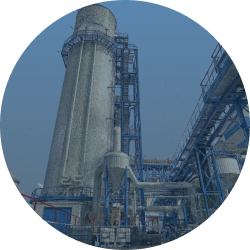
Both in industry and in construction we often encounter a situation when there is a lack of complete technical documentation reflecting the actual state. It is particularly burdensome during the implementation of the task in a facility with very complicated systems of installations, devices or steel structures. Inventory taking with traditional methods in such conditions is very difficult and sometimes even impossible. It consumes a lot of time and is fraught with considerable measurement errors. The ideal solution in this situation is the use of laser scanning.
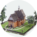
Monuments are testimony of a bygone era. Protection and care for the preservation of monuments for future generations are important because of their historical, scientific or artistic value. In order to record the current state of monuments, an inventory is carried out. Currently, laser scanning is increasingly used for this purpose. Importantly, from the point of view of the study of monuments, the use of this method allows you to make measurements without the need for direct contact with the object. It is also worth noting that the laser scanner allows you to inventory of hard-to-reach points, e.g. high towers.

The measurement of trees included in urban greenery causes many difficulties, mainly due to their irregular shape. The methods of their inventory in cities consist in determining the species, measuring the thickness of the trunk, height and location in the adopted geodetic system. Due to the time consuming nature and the huge impact of the person performing such measurements on their accuracy, laser scanning is increasingly used here.

3D models of urban buildings are a perfect complement to traditional maps in spatial planning. In addition to the airborne laser scanning used so far, terrestrial laser scanning is increasingly used to register urban areas with a smaller area or individual objects.


